Jökulsárgljúfur
Winter conditions by Dettifoss
At the beginning of October it started to snow at Dettifoss and temperature dropped below zero. This means that, even though there may be warmer days in between, winter conditions can still be expected until spring. The conditions of the trails in the area can therefore change often and quickly due to quick changes in the weather. For safety reasons, the trails near the edges of the canyon have been closed for the winter. Instead, a winter route to the viewing platform north of the waterfall has been opened. Read more
About Jökulsárgljúfur Canyon
– Come visit
About Jökulsárgljúfur Canyon
– Come visit
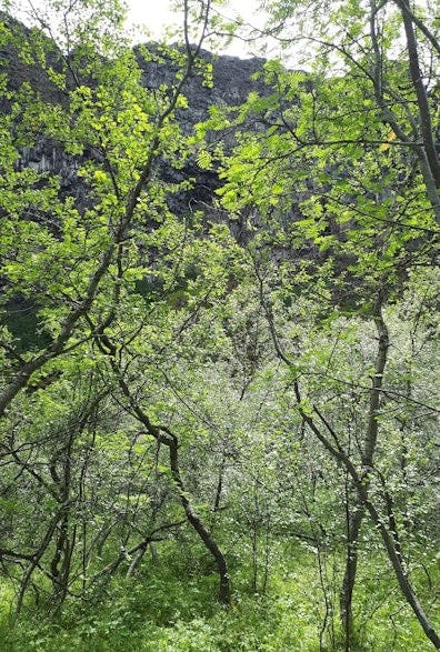
Jökulsárgljúfur was declared a protected national park in 1973 and has been part of Vatnajökull National Park since 2008. The region is part of Norðurþing municipality and spans from Dettifoss in the south to Ásbyrgi in the north. The region is characterised by the river Jökulsá á Fjöllum, paths of catastrophic floods and obvious signs of volcanic activity. The natural habitats vary: furthest south are gravelly plains, in the middle are loess soil fields and wetlands, and the northernmost area is characterised by forests. As a result, the birdlife is very diverse.

Accessibility and services
Jökulsárgljúfur is easily accessible by Route 85 from Kelduhverfi or by Route 1 in Mývatnsöræfi. Dettifossvegur (road number 862) lies to the west of Jökulsá á Fjöllum. The region is accessible year-round, weather and road conditions permitting. The region is a hikers' paradise. Outside of the summer months, conditions can change rapidly. It is therefore important to inform yourself before visiting. There are good toilet facilities at the major destinations. A privately operated restaurant, supermarket and seasonal tourism services are located at Ásbyrgi.

Interpretation and information
Park rangers are responsible for supervision, information and educational services in the region year-round. There is a long and rich tradition of organised educational programmes by park rangers in Jökulsárgljúfur during the summer. Gljúfrastofa, the visitor centre at Jökulsárgljúfur in Ásbyrgi, is open year-round. There are rest stops with information plaques along Dettifossvegur (road 862). Deep at the bottom of Ásbyrgi is a visitors' path that emphasises how plants are used and provides information about folklore related to plants.


Gljúfrastofa Visitor Centre at Ásbyrgi
Gljúfrastofa at Ásbyrgi is the visitor centre for Vatnajökull National Park located in Jökulsárgljúfur. The centre has an excellent educational exhibition and provides comprehensive information about the park and its environs, hiking trails, natural attractions, history, services and recreational options.
Ásbyrgi campsite
There is a large campsite at Ásbyrgi with facilities for tents, trailer tents and caravans. Electrical outlets are available on site. The campsite is open from the middle of May to the end of October every year. In the summer of 2024 the campsite will be opened on May 20th.
Nature & history
- Learn & discover
Nature & history
- Learn & discover
Jökulsárgljúfur and its surroundings have charmed many a traveller. The complex of waterfalls in Jökulsá á Fjöllum, consisting of Selfoss, Dettifoss, Hafragilsfoss and Réttarfoss, have few rivals in the world. The magnificent environment of Jökulsárgljúfur has been formed by water, fire and ice. Enormous catastrophic glacial floods are believed to have created and carved out the canyons, ravines, rocks and basins. The most famous of these formations is Ásbyrgi. Hljóðaklettar are the cores of ancient volcanoes where Jökulsá has swept away all the loose volcanic material. A little further to the north are Rauðhólar, the original scoria cones.

Jökulsá á Fjöllum
The river Jökulsá á Fjöllum emerges from beneath the Vatnajökull ice cap and flows out to sea in Öxarfjörður Bay. At the edge of the highland, the land drops and the river plunges in a series of powerful waterfalls into the canyon that bears its name. The Jökulsárgljúfur canyon is one of the largest and most impressive river canyons in Iceland. It is 25 kilometres long, ½ kilometres wide and in many places over 100 metres deep. Jökulsá á Fjöllum is the force that created Jökulsárgljúfur. For thousands of years, the river carved out the canyon with the diligent support of the catastrophic glacial outburst floods from Vatnajökull. The drainage basin of Jökulsá á Fjöllum is the largest in the country and remains almost untouched by human activity. The region offers a unique opportunity to develop an understanding of the nature of glacial rivers and their impact on land formation and the flora and fauna of land and sea. There are not many places where you can experience the power of glacial rivers as intensely as at Jökulsá á Fjöllum.


Volcanic activity and catastrophic glacial outburst floods
The Jökulsárgljúfur canyon is shaped by the unique interplay of fire and water, and many formations in the region bear witness to this. The canyon connects to the Northern Volcanic Zone and three fissure swarms, named after Krafla, Fremrinámar and Askja, run through the region. Eruptions occurred in at least two of these fissure swarms after the Ice Age, and traces of their volcanic activity can be seen all over Gljúfur. Massive and powerful glacial outburst floods originating from under Vatnajökull rushed into Jökulsá á Fjöllum, most recently around 2000 years ago, carving out the Jökulsárgljúfur canyon and permanently changing the landscape previously shaped by fire. The floods were among the greatest ever to occur on Earth since the Ice Age, and their erosive power was tremendous. With the help of weathering—the force that breaks up rock bit by bit—the basaltic lava was carried off in these great floods. Traces of forces and other formations characteristic of the paths of ancient floods are visible in Jökulsárgljúfur.


