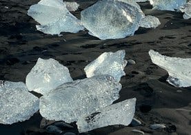
Jökulsárlón
You walk from the main parking lot north towards the glacier and up to the glacier ridge called Helguhóll.
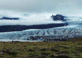
There is a beautiful view from Helguhóll where you can see Jökulsárlón and Breiðamerkursandur. You continue north along a marked path and down from the ridge and down to a cove, which is colloquially called Bátavík. Continuing to the north up to the next moraine and follow it to the end. From the moraines there is a good view of Breiðamerkurjökull. In good visibility you can see Mávabyggðir and Esjufjöll peeking out from the glacier. When you come down from the second moraine, you walk along the lagoon to the south and back to the main parking lot.

